Geography and context
The Beagle Channel is a strait at the southern tip of South America linking the Pacific and Atlantic Oceans. According to Wikipedia, it runs approximately 280 km long with an average width of slightly over 2 nautical miles, narrowing to 1.3 km at Paso Mackinlay and approximately 650 metres at Punta Divide. Depths range from up to 300 metres in the western section to as shallow as 14 metres in Paso Mackinlay; the central zone averages 150–200 metres.
The channel was explored in 1830 by Lieutenant Murray aboard HMS Beagle; Charles Darwin crossed it in 1833. It forms the natural boundary between Argentina to the north and Chile to the south. Notable islands include Tierra del Fuego, Navarino, Hoste, Picton and Nueva, with some peaks exceeding 1,000 metres elevation.
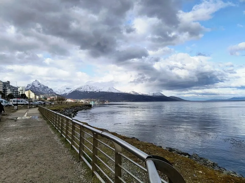
Ushuaia sits on the northern shore at 54°48′S 68°18′O, at the foot of the Martial Range. It is the southernmost city in the world accessible by road. The city has an international airport and National Route 3 is its sole land connection to the rest of Argentina.
What you’ll see
The Beagle Channel is a cold-water dive destination with fauna characteristic of sub-Antarctic ecosystems. Whale calls and extreme cold are part of the experience.
Marine life includes Patagonian king crabs (centollas, Lithodes santolla), crabs, starfish, sea urchins, kelp forests and sea lion colonies. Islands within the channel have permanent haul-outs observable from tour boats and accessible during dives.
Regarding the Monte Cervantes wreck: this 160-metre German cargo-passenger ship of the Hamburg South American Line ran aground in January 1930 near the Les Eclaireurs lighthouse islets after striking a reef. All passengers were evacuated successfully; the captain disappeared. In 1954, Argentine salvage company Salvamar refloated the hull, but during towing to Ushuaia it broke apart and sank again — this time at 75–100 metres depth according to Wikipedia. This depth places the main wreck well outside standard recreational diving limits.
Tierra del Fuego National Park, established in 1960, covers more than 68,000 hectares of Andean-Patagonian forest with Beagle Channel coastline included. It is Argentina’s southernmost national park and serves as a staging point for Antarctic expeditions.
When to go
Diving operates year-round. Winter brings minimum water temperatures and more demanding conditions, but visibility can be superior when plankton retreats. Summer offers slightly warmer water and more operators active in the area. Ushuaia’s subpolar oceanic climate means variable skies in any season.
How to get there
Ushuaia has an international airport with frequent flights from Buenos Aires (Aeroparque and Ezeiza) and some southern cities. By land, National Route 3 is the only access road, requiring passage through Chile if approaching from the north. Cruise ships and passenger boats also connect from Punta Arenas, Chile.
APN (Tierra del Fuego National Park): San Martín 1395, Ushuaia (Tel. +54-2901-577931; [email protected]).
Protected areas and regulations
The western section of the Beagle Channel falls within Chile’s Alberto de Agostini National Park. The eastern region includes the Cabo de Hornos Biosphere Reserve. Argentina’s Tierra del Fuego National Park, administered by the APN, covers the Argentine shore.
All commercial diving requires Argentine Naval Prefecture authorisation. Extreme channel conditions require operators with specific sub-Antarctic experience. A drysuit is strongly recommended for most of the year.
Sources
- Wikipedia ES — Canal Beagle (geography, dimensions, fauna, history, protected areas)
- Wikipedia ES — Ushuaia (geography, access, fauna, national park)
- Wikipedia ES — Monte Cervantes (shipwreck history, final depth of remains)
- argentina.gob.ar — Tierra del Fuego National Park (park description, APN contact)
- CADIC-CONICET — Deep survey of the Beagle Channel (water temperature and salinity, biweekly monitoring since 2014)
- Turismo Ushuaia — Penguin colony navigation (Spheniscus magellanicus season at Isla Martillo: Oct–Apr)
- INIDEP — King crab stock survey Beagle Channel (Lithodes santolla: southern zone evaluation, fishing closure Mar–Jun)
Technical tips
The Beagle Channel requires a drysuit without exception: water temperature stays between 4°C and 8°C year-round. Currents can be strong in the open channel; most sheltered sites have calmer conditions. Visibility is excellent in austral summer (Nov–Feb), reaching up to 12 meters, thanks to low plankton levels in sub-Antarctic waters. The giant kelp forest (Macrocystis pyrifera) creates a striking environment; navigating it requires precise buoyancy to avoid damaging the kelp or getting entangled. Access to the Monte Cervantes requires a Prefectura Naval permit; check with your operator for current conditions.